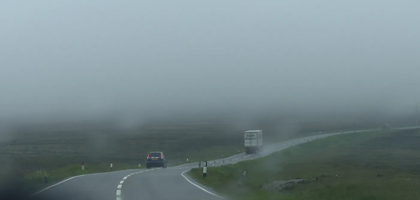

Six roads close 18 to 23 September in Macclesfield, Wilmslow, Bollington and Prestbury. The A54 stays shut to 30 October and a second bridge is on one lane.
Six residential roads across the Macclesfield side of the borough close between 18 and 23 September. Cheshire East rewrote its micro surfacing dates again on 17 September, and every date we published ten days ago has moved.
Two bigger things have changed with it. A collision has put a second bridge on a single lane under temporary lights, this one on the B5470 Macclesfield Road. And Poynton village centre, which readers were told was finished, is coming back for four days in October.
This page covers what is closed now, what is booked for the weeks ahead, and the practical detail that does not change: parking prices, the station and the buses.
Check today’s closures first
Cheshire East publishes a live map and table of current and upcoming roadworks, covering council and utility works, road closures and abnormal loads. The same page links through to one.network, where you can register for email alerts for a specific area. As everywhere, the map relies on utility firms keeping their entries current, so treat it as a strong guide rather than gospel.
Closed this week: six roads, 18 to 23 September
The council’s micro surfacing programme shuts residential roads for a day or two at a time. The dates have moved twice in a month. The council blames the hot spell for the first slip; the table it published on 17 September moves them again. These are the dates as they now stand, all weather dependent (micro surfacing programme):
- Lacey Green, Wilmslow: 17 and 18 September (ironworks 22 to 25 September, markings 30 September and 1 October)
- Henshall Road, Bollington: 18 and 19 September (markings 3 and 4 October, ironworks 4 to 10 November, no weekend working)
- Heybridge Lane, Prestbury: 19 September, for remedial works and ironworks
- Bollingbrook Road, Macclesfield: 19 September, for remedial works and ironworks
- Brocklehurst Avenue, Macclesfield: 20 September (markings 19 and 20 October)
- Peter Street, Macclesfield: 23 September (ironworks 2 and 3 November)
Peter Street has moved the furthest: we published it for 15 and 16 September, and it is now 23 September. Brocklehurst Avenue was “date to be confirmed” and now has one. South West Avenue in Bollington is complete.
What it means for you: if your road is on that list, move the car off it before the crew arrives, and expect access on foot only for the couple of hours the surface takes to harden. If a newly treated road looks uneven or the manhole covers sit low, that is expected, and the council asks you not to report it as a defect.
A54 to Buxton: closed until 30 October
Derbyshire County Council has closed a 2.8km stretch of the A54 between the A53 Leek Road junction and the junction with the A537 at the county border, the moorland section locally known as part of the Cat and Fiddle run, to rebuild the carriageway and put in new drainage. Phase 1 runs from 27 July to 30 October 2026, closed to all traffic, with a signed diversion via the A53, A523, A537 and A54. A second phase of about twelve weeks follows from around April 2027, reinforcing the earth banks that have been sliding onto the road (Derbyshire County Council scheme page).
The closure reshapes the bus network over the hill. High Peak’s route 58, the hourly Macclesfield to Buxton service over the Cat and Fiddle, is running via Long Hill and the B5470 through Rainow for the duration, on a revised timetable. Most journeys now run beyond Macclesfield bus station to serve the Black Road area. Burbage cannot be served at all while the road is shut, and High Peak says the East Midlands Combined County Authority is “currently looking at options for Burbage residents” (High Peak Buses). Derbyshire also lists Centrebus service 60 between Buxton and Macclesfield as affected.
What it means for you: the Buxton run is longer than usual until the end of October, whichever way you make it. Allow extra time. If you rely on the 58, check the revised timetable rather than the one you know.
Two bridges, one lane each
Both are the result of vehicles hitting a parapet, and both are now sitting on temporary signals with no repair date attached.
- A537 Chelford Road, Nether Alderley. Temporary concrete barriers have the bridge down to a single lane under temporary traffic signals after a collision damaged the parapet. The council expects the new sandstone blocks by the end of September 2026, with repairs beginning then. That is the same wording it used in August: the page has not been reviewed since 11 August, so the date is now within a fortnight and unconfirmed (Cheshire East).
- Reeds Bridge, B5470 Macclesfield Road (new). A collision has caused “extensive damage” to the north parapet of Reeds Bridge. Temporary concrete barriers have cut the carriageway to a single lane, with temporary two-way traffic lights that the council says “will remain in place until repairs can be carried out”. No start date for those repairs has been published. The page was first reviewed on 10 September 2026 (Cheshire East).
Worth knowing: the council’s Reeds Bridge page does not say where on the B5470 the bridge sits, and the B5470 Macclesfield Road is the same hill road the diverted 58 is using while the Cat and Fiddle is closed. We could not pin the bridge down from any source we can read today, so treat the signs on site as the guide.
Poynton: the village centre comes back in October
The Poynton Shared Space scheme has been rebuilding the village centre since 16 March. The council’s table now marks every resurfacing phase complete, including the phase 4a drainage work on London Road South (4 to 11 September).
What has changed since our last check is that the last phase finally has dates. Phase 4b, refreshing the road markings on the Fountain Place roundels and polishing the granite setts, runs from 5 October to 8 October 2026, under three-way temporary traffic signals, and London Road South will be closed while the Fountain Place work is carried out. The council says it is returning in October because utility works already planned in the area will use the shared space as their diversion route (Cheshire East scheme page, reviewed 7 September).
Read that page yourself and you will find it still contradicts itself. The paragraph above the table says the resurfacing of London Road North, London Road South and Chester Road “will take place at a later date, when the utility works have been completed”. The table below marks all three complete, and the progress note further down says plainly: “We have completed the drainage and resurfacing works on Chester Road, London Road North and London Road South.” The council has not reconciled the two. The table and the progress note agree with each other, so they are the ones to believe.
What it means for you: four more days of disruption in the village centre, 5 to 8 October, and then the scheme should be done. Buses have run revised routes throughout, so check the operator before you travel.
Wilmslow to Handforth: Manchester Road works start 5 October
Cheshire East confirmed on 17 September that phase 2 of the Manchester Road active travel scheme starts on Monday 5 October and runs to spring 2027. The scheme, funded by Active Travel England, is building a 1.5-mile walking and cycling route between Wilmslow town centre and Handforth; phase 1 is finished and open.
Phase 2 includes:
- an extension of the segregated two-way cycleway along Manchester Road
- improvements to the Network Rail bridge to fit the new cycling infrastructure
- cycle bypasses at two bus stops
- two new zebra crossings, at Bluebell Way and Styal Road
- footway improvements
The traffic management is the part worth diarising, because it runs for five months and ends in a full closure (project page, reviewed 14 September):
| Work | Dates | Traffic management |
|---|---|---|
| Site set up | 5 to 9 October 2026 | None |
| Wilmslow Cemetery entrance | 7 to 15 October 2026 | Two-way signals, lane restrictions |
| Railway bridge and bus stops | 16 and 17 October 2026 | Two-way signals, lane restrictions |
| Bluebell Way junction | 17 November to 16 December 2026 | Three-way signals, lane restrictions |
| Manchester Road footpath repairs | 16 and 17 December 2026 | To be confirmed |
| Styal Road junction | 18 December 2026 to 10 February 2027 | Three-way signals, lane restrictions |
| Carriageway resurfacing and lining | 11 February to 1 March 2027 | Full closure, Stanneylands junction to Styal Road |
| Cycle lane kerb installation | 2 to 31 March 2027 | Two-way signals, lane restrictions |
The council held a public engagement event at Wilmslow Library on 10 September. Cabinet member for highways and transport Councillor Mark Goldsmith said a separate cycle lane on each side of the road was “a common request”, but that “the environmental and financial cost for this is just too high”, because the road would have to be widened and that “would remove the mature beech trees that are a key part of the character of Manchester Road” (council statement, 17 September 2026).
Late-night trains: buses from 21 to 24 September
Engineering work in the Manchester Piccadilly and Stockport area closes some lines on the evenings of Monday 21 to Thursday 24 September. Four late services on our line are affected (National Rail):
- the 23:16 Manchester Piccadilly to Macclesfield is bus replaced throughout
- the 22:46 Manchester Piccadilly to Stoke-on-Trent is bus replaced throughout
- the 23:11 Crewe to Manchester Piccadilly will not call at stations between Wilmslow and Piccadilly, with a bus from Wilmslow
- the 23:36 Manchester Piccadilly to Crewe leaves a minute later, runs via Heald Green and will not call between Piccadilly and Wilmslow, with a bus covering those stops
What it means for you: if you are coming home late from Manchester on any of those four nights, the last train is a bus. Allow the extra time, and check the journey planner on the day. Where the trains go and what they cost is on our trains to London page.
The rest of the picture
- Brook Lane, Alderley Edge: two-way lights on the bridge. Brookfield Bridge carries Brook Lane (the B5085) over Whitehall Brook, and the council has put in temporary two-way traffic lights “to remove vehicle loading from the edge of the carriageway” until it can be strengthened. “Unsuitable for HGVs” signs are up, and local businesses have been asked to route lorry deliveries elsewhere. Lining works, fitting a strengthening lining inside the existing arch, are due to start in late autumn 2026, when the traffic management becomes a mix of temporary lights and road closures (Cheshire East, reviewed 26 August). Most of the work happens under the bridge, so there will be little to see from the road.
- Pickmere Lane, Pickmere: closed until further notice. The B5391 is shut where it crossed Waterless Brook. Inspections showed the arch was deteriorating and could collapse, so the bridge was taken down in a controlled demolition in April 2025 and United Utilities put in a temporary water main diversion. The site is closed to everything, including pedestrians, cyclists and horse riders, and emergency access cannot be allowed. Ground investigations found artesian water, halite and old brine pumping under the site; specialist contractors are now gathering the information needed to choose a replacement option, and the council is aiming to start construction in summer 2027 (Cheshire East, reviewed 27 July). A signed diversion is in place. This one matters most if you drive between Knutsford and the Pickmere or Plumley side.
- Congleton Road / Moss Lane junction, Macclesfield: works cancelled. The right-turn lane agreed with a housing developer back in 2017 will not now be built; the council said on 6 August 2026 that traffic assumptions had “changed significantly” over nine years, and it will take a financial contribution and review the junction afresh (council statement).
- B5470 at Rainow: fully open. The embankment between Ginclough and Kettleshulme that collapsed in January 2025 has been rebuilt, with one-day inspections under temporary lights every three months, planned off-peak where possible (Cheshire East).
- Brook Street riverside footpath: still closed. The path between Brook Street and Waterside by the River Bollin remains shut after a wall partially collapsed. Peaks & Plains Housing Trust owns the wall and is managing the rebuild. No reopening date has been published, and the council’s page on it has not been reviewed since 19 November 2024 (Cheshire East).
- Surface dressing: mostly done, two sites postponed. The 2026 programme has been completed on the A537 and A523 at Gawsworth, the B5071 Pexhill Road and the A54 at Holmes Chapel. Remedial works remain postponed on the A6 Buxton Road West at Disley and on the A535 through Chelford (programme page).
Booked in: patching in Rainow, Wilmslow and Macclesfield
The council runs a second, quieter programme that patches localised defects rather than resurfacing a whole road, and it is not linked from the main roadworks list in the way the big schemes are. Its page says the programme “started in May 2026 and will run through to August 2026”, while its own table lists work into October, so read the table rather than the sentence (micro surface patching programme):
- September 2026: Erwin Lane, Hooleyhey Lane and Saltersford, Rainow; Sugar Lane, Rainow
- October 2026: Parkway, Wilmslow; Sagars Road, Wilmslow; Tunnicliffe Road, Macclesfield; Waterside and Lower Bank Street, Macclesfield
Only approximate months are published for these, not dates.
Booked in: Chapel Lane, Wilmslow, in November
The council’s separate resurfacing programme, which starts borough-wide in October, has one entry on our side of the borough. Chapel Lane in Wilmslow, between Oak Lane and Alderley Road, is down for daytime work from 18 to 23 November, 8am to 5pm, followed by overnight work from 24 to 27 November, 7pm to 6am (resurfacing programme 2026). Signed diversions will be in place, and the council asks for vehicles to be moved off the road before work starts.
For motorway and trunk-road works around the borough, check National Highways’ travel updates before a long trip.
What parking actually costs
Macclesfield’s council car parks sit in three price bands, and picking the right one roughly halves a full day: £4.20 for 14 hours at Duke Street, Jordangate or Whalley Hayes, £6.20 at Churchill Way, the Grosvenor or Pickford Street, and £8.80 at Gas Road or Waters Green nearest the station. Charges now run 8am to 10pm, seven days a week. Kennedy Avenue and Princes Way are free, Duke Street is free after 3pm, and the Town Hall area opens free after 5pm on weekdays.
Every car park, tariff, permit price and the £70 penalty rules are set out on our parking in Macclesfield page.
The key routes, for orientation
- A523 Silk Road: the north-south spine through town, Stockport one way, Leek the other.
- A537: west to Chelford and the M6 (mind the Nether Alderley bridge lights), east over the moors to Buxton as the Cat and Fiddle road.
- A34: the through-route on the western side, carrying Wilmslow, Handforth and Alderley Edge traffic.
- A538: Prestbury to Wilmslow and on to the airport.
- B5470: the hill road through Rainow to Whaley Bridge, currently doubling as the 58 bus diversion and carrying the Reeds Bridge lights.
The A537 Cat and Fiddle stretch earned a EuroRAP “most dangerous road in Britain” rating in 2008, and around 70% of its casualties between 2001 and 2015 were motorcyclists; a 50mph limit and average-speed cameras arrived in 2010 and it had dropped out of the danger top ten by 2015 (Cat and Fiddle Road, Wikipedia). It remains a road to respect in bad weather, and its summit is the second highest inn in England, at 1,690 feet.
Buses
Local town routes are run by D&G Bus, including the 19/19A to Prestbury via Upton Priory (D&G timetable), with High Peak running the 58 over the hill to Buxton (High Peak Buses). The demand-responsive go-too minibus service was extended borough-wide on 3 August. The free bus travel for children that Cheshire East offered ran through August only, and has now ended (council media hub). If the bus or car is taking you somewhere nice, our things to do page has the destinations.
Frequently asked questions
Which roads are closed in Macclesfield this week?
Six roads close between 18 and 23 September for micro surfacing: Lacey Green in Wilmslow, Henshall Road in Bollington, Heybridge Lane in Prestbury, and Bollingbrook Road, Brocklehurst Avenue and Peter Street in Macclesfield. The dates were revised by the council on 17 September and are weather dependent.
Why is the road to Buxton closed?
Derbyshire County Council is reconstructing 2.8km of the A54 between the A53 junction and the A537 at the county border. Phase 1 runs from 27 July to 30 October 2026 with a signed diversion via the A53, A523, A537 and A54; phase 2 follows from around April 2027.
Is the Cat and Fiddle bus still running?
Yes. The hourly High Peak 58 between Macclesfield and Buxton is diverted via Long Hill and the B5470 through Rainow on a revised timetable, with most journeys extended beyond Macclesfield bus station to the Black Road area. Burbage cannot be served while the A54 is shut.
Is Poynton village centre still closed?
The resurfacing is finished. The last phase, refreshing the Fountain Place roundel markings and polishing the granite setts, runs from 5 to 8 October under three-way signals, and London Road South closes while the Fountain Place work is done.
When will the A537 bridge at Nether Alderley be repaired?
The bridge is down to a single lane under temporary signals. The council expects the replacement sandstone blocks by the end of September 2026 and says repairs begin once they arrive, but it has not reviewed that page since 11 August.
Where is the cheapest parking in Macclesfield?
Kennedy Avenue and Princes Way are free. Of the charged car parks, the standard band (Duke Street, Jordangate, Whalley Hayes and others) is 80p an hour and £4.20 for a 14-hour day, and Duke Street is free after 3pm. The Town Hall area is free to the public after 5pm on weekdays.
Where should I park for Macclesfield station?
The station’s own ANPR car park has only 64 spaces. The council’s long-stay station car park (SK11 6JP) is £13.20 a day; Waters Green, a short walk away, is £8.80 for 14 hours.
Where can I check live roadworks near me?
The council’s roadworks map shows current and planned works across Cheshire East, and you can set up email alerts for your area on one.network.
Sources
- Cheshire East roadworks map and hub (live closures, one.network alerts)
- Derbyshire County Council: A54 Macclesfield Main Road scheme (closure dates, extent, diversion, services 58 and 60)
- High Peak Buses route 58 (diversion, revised timetable, Burbage)
- National Rail: Manchester Piccadilly and Stockport area engineering work, 21 to 24 September
- Cheshire East scheme pages: A537 Chelford Road bridge damage, Reeds Bridge, B5470 Macclesfield Road, Poynton Shared Space works, Manchester Road active travel scheme, B5470 Rainow repair, Brook Street footpath closure, Pickmere Lane partial arch collapse, surface dressing 2026, micro surfacing programme, micro surface patching programme, resurfacing programme 2026, Brook Lane Bridge, Alderley Edge
- Cheshire East: Manchester Road active travel phase 2, 17 September 2026
- Cheshire East: Congleton Road / Moss Lane statement, 6 August 2026
- Cheshire East: car parks in Macclesfield (all tariffs)
- National Rail: Macclesfield station (station parking)
- Cat and Fiddle Road (Wikipedia) (safety history)
Roadworks dates move with weather and contractor progress. Details above were checked against the linked sources on 18 September 2026; always check the live map before a journey that matters.
Have your say